The National Aeronautical and Space Agency (NASA) unveiled images of the Earth as it looks at night during the ongoing American Geophysical Union (AGU) fall meeting in San Fransisco, USA. The images are from the new NASA and National Oceanic and Atmospheric Administration (NOAA) Suomi NPP satellite and are a composite of cloud free images acquired throughout the year using the day-night band of its Visible Infrared Imaging Radiometer Suite (VIIRS).
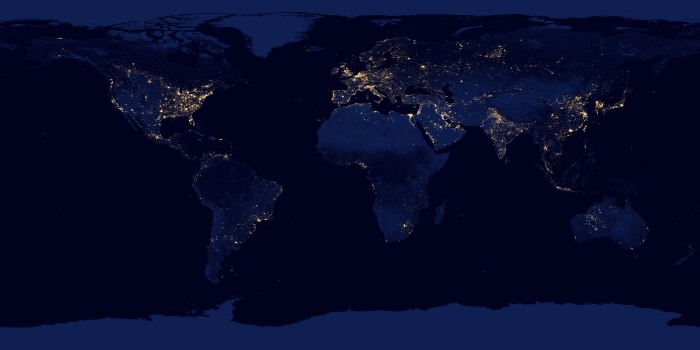
Looking at high-resolution imagery of the globe the first striking thing is the apparent Island of Darkness surrounded by light that is Africa. Unlike Europe and Asia with bright spots of human lighting most of Africa is dark, except for South Africa, the Nile Delta in Egypt and South eastern Nigeria (to be precise the Niger Delta).
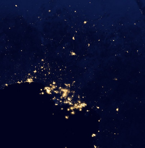
Taking a close look at the country itself on can easily point out bright spots corresponding to Lagos and Abuja at night (Generators possibly) and the very bright spots in the Niger Delta (some offshore) are actually gas flares from the many oil wells in the area. A stark visible reminder of the economic and environmental cost of flaring which in spite of all the hot air from the government is still continuing.


